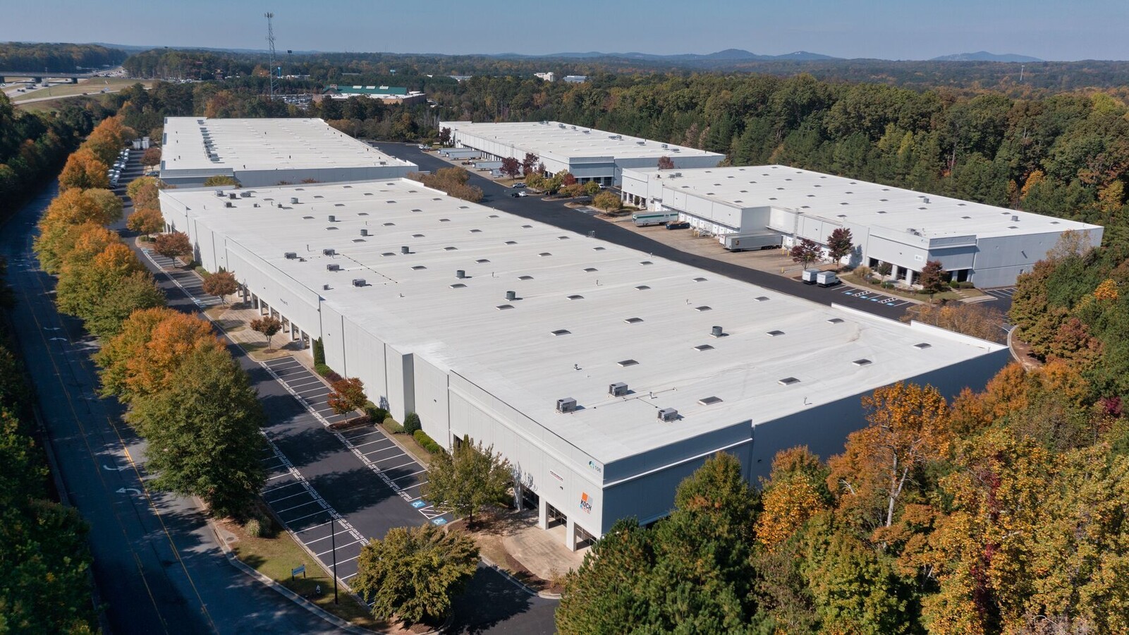
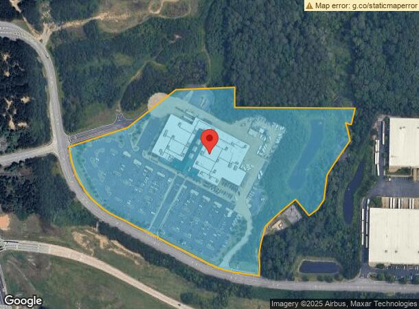
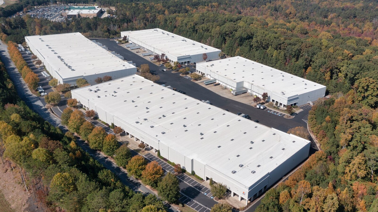
Property Record
152 Northpoint Pky, Acworth, GA 30102

Current Lease Availabilities
NEARBY LISTINGS FOR SALE OR LEASE
Property Detail
152 Northpoint Pky
021N06-00000-057-000-0000
LL 1275,1276 21ST D
Departmentstore
Cherokee
X
Georgia
13057C0309E
16.45 AC
2024
Kennesaw/Acworth
2024
Atlanta
091104
Atlanta-Sandy Springs-Roswell, GA
97,327 SF
DEMOGRAPHICS near 152 Northpoint Pky
1 Mile
3 Mile
5 Mile
2024 Total Population
7,428
61,285
136,228
2029 Population
7,851
64,775
143,815
Pop Growth 2024-2029
+ 5.69%
+ 5.69%
+ 5.57%
Average Age
37
38
39
2024 Total Households
2,686
22,091
49,750
HH Growth 2024-2029
+ 5.29%
+ 5.61%
+ 5.54%
Median Household Inc
$79,995
$86,830
$83,712
Avg Household Size
2.70
2.70
2.70
2024 Avg HH Vehicles
2.00
2.00
2.00
Median Home Value
$269,844
$269,100
$274,433
Median Year Built
1997
1995
1993
Nearby Places
- Restaurants
- Banks
- Shops
- Fitness
- Groceries
Nearby Properties
Address
Land Use
TOTAL SIZE
Lot Size
Zoning
Address
Land Use
TOTAL SIZE
Lot Size
Zoning
42,713 SF
17.71 AC
RTH
Address
Land Use
TOTAL SIZE
Lot Size
Zoning
1,120 SF
42.20 AC
HI
Address
Land Use
TOTAL SIZE
Lot Size
Zoning
121,404 SF
39.92 AC
LI
Address
Land Use
TOTAL SIZE
Lot Size
Zoning
28,398 SF
22.95 AC
C1
Address
Land Use
TOTAL SIZE
Lot Size
Zoning
174,960 SF
3.99 AC
MU
Address
Land Use
TOTAL SIZE
Lot Size
Zoning
225,382 SF
18.66 AC
RM-8
Address
Land Use
TOTAL SIZE
Lot Size
Zoning
212,038 SF
24.96 AC
RM-8
Address
Land Use
TOTAL SIZE
Lot Size
Zoning
49,189 SF
8.99 AC
RM16
Address
Land Use
TOTAL SIZE
Lot Size
Zoning
200,596 SF
16.04 AC
RM-8
Address
Land Use
TOTAL SIZE
Lot Size
Zoning
350,984 SF
23.10 AC
LI
Address
Land Use
TOTAL SIZE
Lot Size
Zoning
311,900 SF
24.69 AC
LI
Address
Land Use
TOTAL SIZE
Lot Size
Zoning
128,292 SF
56.66 AC
I1
Address
Land Use
TOTAL SIZE
Lot Size
Zoning
139,642 SF
28.14 AC
R-40
Address
Land Use
TOTAL SIZE
Lot Size
Zoning
187,127 SF
16.79 AC
LI
Address
Land Use
TOTAL SIZE
Lot Size
Zoning
156,945 SF
18.03 AC
RM-8
Address
Land Use
TOTAL SIZE
Lot Size
Zoning
171,752 SF
11.14 AC
LI
Address
Land Use
TOTAL SIZE
Lot Size
Zoning
195,600 SF
14.59 AC
LI
Address
Land Use
TOTAL SIZE
Lot Size
Zoning
61,867 SF
4 AC
Address
Land Use
TOTAL SIZE
Lot Size
Zoning
112,812 SF
16.17 AC
LI
Address
Land Use
TOTAL SIZE
Lot Size
Zoning
303,860 SF
LI
Address
Land Use
TOTAL SIZE
Lot Size
Zoning
115,210 SF
9.66 AC
RM-8
Address
Land Use
TOTAL SIZE
Lot Size
Zoning
223,540 SF
12.74 AC
LI
Address
Land Use
TOTAL SIZE
Lot Size
Zoning
230,767 SF
14.69 AC
LI/WS
Address
Land Use
TOTAL SIZE
Lot Size
Zoning
2,016 SF
12.29 AC
HI
Address
Land Use
TOTAL SIZE
Lot Size
Zoning
17,623 SF
11.83 AC
GC
Address
Land Use
TOTAL SIZE
Lot Size
Zoning
212,290 SF
17.54 AC
Address
Land Use
TOTAL SIZE
Lot Size
Zoning
258,400 SF
19.55 AC
Address
Land Use
TOTAL SIZE
Lot Size
Zoning
166,200 SF
14.51 AC
C2
Address
Land Use
TOTAL SIZE
Lot Size
Zoning
108,214 SF
15.40 AC
LI
Address
Land Use
TOTAL SIZE
Lot Size
Zoning
69,249 SF
2.96 AC
MU
The World's #1 Commercial Real Estate Marketplace
Connect with us
© 2025 CoStar Group
The information above has been obtained from sources believed reliable. While we do not doubt its accuracy we have not verified it and make no guarantee, warranty or representation about it. It is your responsibility to independently confirm its accuracy and completeness. Any projections, opinions, assumptions, or estimates used are for example only and do not represent the current or future performance of the property. The value of this transaction to you depends on tax and other factors which should be evaluated by your tax, financial, and legal advisors. You and your advisors should conduct a careful, independent investigation of the property to determine to your satisfaction the suitability of the property for your needs.